


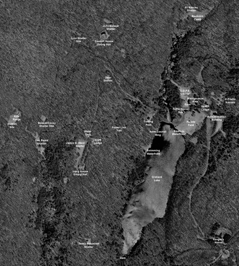
May 2, 1997 was a quiet day at Onteora. The camp was closed, and the grounds silent. Far, far overhead, though, a satellite passed by and photographed the area in amazing detail. While images such as this are commonplace today due to tools like Google Earth, in 1997 this was pretty amazing stuff. It also captured Onteora just before it re-opened in 1998.
To capture all of Onteora in one photo, I downloaded fifteen scans from Microsoft's Terraserver site, then manually stitched them together into one large view of the property. I then added captions to describe major points of interest. I was really surprised to see that structures as small as a Program Shelter could clearly be seen, or that some of the trails and roads could be easily spotted.
There are two versions of the photo of Onteora available. Click on either of these descriptions to download:
800x891 resolution - 392KB file
1443x1607 resolution - 914KB file
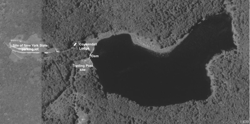
There is also an aerial view of the Alder Lake property:
800x399 resolution - 93KB file
Just click on your browser's back arrow key to return to this page from the photos.
Click here to return to the main Onteora page or use the menu at the top of the page to explore more of the site.