|
Onteora Scout Reservation: |
||||
| After you've read the early 1960's trail guide, you might find it interesting to see some of
the changes found in this guide from 1967. The Ernest Steinbrenner trail is completely
missing, and there are some new trails and side destinations. There's also some
information not on the other guides I have found so far, such as the fact that a camper
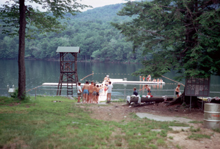
evidently took an unplanned dive off Wildcat Falls! Thanks to Jean-Pierre Moreau for a copy of the guide! THE WHITE TRAIL The White Trail is the boundary trail at Onteora. It travels through some of the most beautiful country at camp, including many interesting rock formations. HIKING STUMP - The trail starts at the Hiking Stump and follows the lake road past the waterfronts. Past the dam at the junction of the upper and lower roads, the trail goes off to the right and up through the woods. LAKE UNCAS - The trail passes Lake Uncas on the left. This is a private lake and the site of a Catholic Camp. DO NOT TRESPASS! ROCKY LEDGES - The trail continues up Rattle Hill through a series of rock cliffs and ledges. RATTLE HILL - It then emerges at the top of Rattle Lean-to. Here the trail turns left on the Hunter Road 1/8 mile down Rattle Hill and then turns right into the other outpost lean-to. NEW LEAN-TO - The trail passes this lean-to on the right and continues off through the woods to an old logging road. LOGGING ROAD - Here the trail turns left until it joins a major logging road. It turns right on the road and follows it in a wide arc until it joins the Alder Lake Trail. Along the logging road you can see Tom Quick's Stone Quarry, many deer tracks, and a number of interesting views. ALDER LAKE TRAIL - The White Trail ends at the Alder Lake Trail. Turn right onto the Alder Lake trail and follow it down hill back to camp. ALDER LAKE TRAIL The Alder Lake Trail covers almost all the types of trails in the Catskills. It goes up and down hills, follows logging roads, dirt roads, macadam roads, goes through wooded areas and a meadow, and crosses a deep ravine. It is approximately 10 miles long and offers a couple of beautiful views. HIKING STUMP - The Alder Lake Trail starts at the hiking stump and follows the Red and Yellow Trails past the Health Lodge. A short distance after the Health Lodge the Red and Yellow Trails fork. Follow the Yellow trail to the right. ALDER LAKE TRAIL - At the top of the hill on the Yellow Trail you will cross a dirt logging road. At this point you will start to follow the Alder Lake Trail markers (White with a Red pie slice.) You will follow these markers all the way to Alder Lake. OLD STAFF TRAINING CAMP - At the old staff training camp the trail will follow an old logging road a short distance and switch north to another along the trail. You will see many deer tracks and a loading skid. LOADING SKID -This is similar to the one we have at Onteora. The logs are rolled up to one end and a truck pulls up to the high end and the log is rolled onto the truck. At this point the trail proceeds into the woods, leaving the logging road. You will notice that the trail is quite rocky. STEEP CLIMB - The trail will begin a steep climb up hill. You will climb from 2400 to 2800 feet. LOGGING ROAD - Near the top of the climb is a Logging road. Proceeding along this road 1/8 mile you will see a double marker; this particular one designates a beautiful view to the left. Follow the beaten path for about 15 yards. Be careful; it is a steep drop. TRICKY TURN - Proceed in 5/10 of a mile from the beautiful view. The trail then turns left into the woods; 1 mile. FALLEN LOGS - Immediately after re-entering the woods, you will come upon 2 logs, one you must climb over and the other you must go underneath. Further on this trail you will come upon 3 trees crossing the trail. The trees lay parallel to the ground and the branches grow straight up. The trail proceeds downhill, enters a meadow, and reaches Shin Creek. SHIN CREEK - The water in Shin Creek is not drinkable. The creek is at the bottom of a 30 foot deep ravine. It is very slippery, steep, and dangerous; going down its banks, be very careful. DIRT ROAD - Proceed 50 yards from the creek and there is a dirt road running north and south. Proceed south and it will turn, running east and west, with another road meeting it going north and south. You proceed east, going up hill. This road passes through a New York State Forest Preserve. At the top of the hill is the halfway point; 5 miles traveled and 5 miles to go. The road and trail proceed down hill passing through some farm fields and passing a few houses. The road veers sharply to the right with a driveway to a barn straight ahead. The trail follows the road to the Beaverkill. BEAVERKILL RIVER - Here you must cross the bridge and proceed left in a north-eastern direction on a macadam road. The distance from this point to the lake is 2 3/4 miles. Alder Creek is to your left and you will pass a farm on your right. About 1/8 mile from the bridge you will see a gravel sifter to your left. The water from Alder Creek is drinkable but respect posted land. About one half mile from the bridge you will pass a wooden bridge on your left. We have permission from the owner to take water upstream of this bridge. Please do not throw rocks or wood into the pool below it. THREE BRIDGES - About 200 yards above the wooden bridge the road crosses Alder Creek. There are two similar bridges further upstream, all utilized by the trail. At the third one, the creek bears right and the road bears left. Follow this to the fork. FORK - Here there are three roads branching out. The trail bears completely right onto a dirt road and drops slightly, but goes steeply up hill. At the top there is a meadow. Proceed along the road and stop at the sign requesting all troops to halt. The Senior Patrol Leader will follow the path down the hill to the right. After he has checked in with the Staff at the outpost store, the Senior Patrol Leader will lead his troop to their assigned camping area. YELLOW TRAIL The Yellow Trail goes to the Fish Hatchery, Toad Hollow, Karst Property, Mongaup Pond, and Frick Pond. HIKING STUMP - The Yellow Trail starts at the Hiking Stump and proceeds up the road toward the Health Lodge. FORK - Just before the Health Lodge the trail forks and you may go either way. The left fork is shorter to Frick Pond and Toad Hollow and the right fork is shorter to the Karst Property, Mongaup Pond, and the Fish Hatchery. The trail guide follows the right fork away from camp and returns to camp via the left fork. HUNTER ROAD - The right fork proceeds through the parking lot and then heads off to the left where the road leaves the parking lot. This part of the trail is part of the Old Hunter Road which was built in 1815 by John Hunter and it opened up the area for settlement. INTERESTING VIEW - About 1.5 miles up the Hunter Road there is a clearing on the right with an old shack in it. From this field a panorama of the surrounding country side can be seen. FROG HOLLOW ROD AND GUN CLUB LODGE - About 1/8 mile farther down the trail there is a large red building on the left. This is the hunting lodge for the Frog Hollow Rod and Gun Club. OLD CEMETERY - Proceeding down the trail there appears on the right an old cemetery. The oldest stone is dated 1855. It is interesting to note the epitaphs carved on some of the older stones. FISH HATCHERY - About 1.5 miles past the cemetery the Hunter Road ends on a paved road and the trail turns left. The large building on the right is the New York State Fish hatchery. Here trout are raised under controlled conditions to stock the rivers and streams of the Catskills. Scouts are asked to be at all times good Scouts and not disturb or touch the fish or any of the equipment as this would upset their controlled breeding process. The Scouts are asked to keep away from the large fly-wheel which is used to pump the water from Toad Hollow to the Hatchery. ROAD TO BEECH MOUNTAIN SCOUT CAMP - About 100 yards past the Fish Hatchery the paved road becomes a dirt road which continues towards Beech Mountain Scout Camp. The trail continues along this road to Frick Pond. FRICK POND - Frick Pond is a part of Beech Mountain Scout Camp. In the center of the pond is a old beaver house There is drinking water about 200 yards down stream from the lake.
CORDUROY ROAD - The trail now goes through the woods following the old Corduroy Road. This road was built over 100 years ago to haul logs through the swampy roads. LOGGING CAMP - To the left of the Corduroy Road there are many fallen-down buildings, the remains of an old logging camp. The trail here turns to the left and weaves along a stream bed. Then it turns to the right and heads up through the woods. SAW DUST PILE - Into the woods a few yards there is a clearing and a small mound of brown sawdust shavings. This is a favorite spot for deer in early morning and late evening. LOGGING ROADS - The trail comes out of the woods on a logging road, turns right, follows the road for a few yards then turns left into the woods. After going about 1/2 mile through the woods the trail comes out on another logging road and turns left. ROCKY LEDGES - Two miles out of camp you will cross a very rocky area. This stretch of the woods is very unusual because when a strong wind blows through the trees and rocks, the grating of trees together creates weird noises and gives rise to many legends about a haunted forest. BASE CAMP ROAD - The Trail, after emerging from the woods, turns right on the Base Camp Road and follows it, past the Old Staff Training Area. HEALTH LODGE - The trail turns left and emerges on the parade grounds by the Health Lodge. SIDE TRIPS WATERFALLS - Proceed along the paved and dirt roads from the Fish Hatchery. Take the first road to the right and follow it to the bridge. Then follow the stream down to the Waterfalls. These are not only interesting but many troops use them for showers. MONGAUP POND - about 300 feet past the turn off to the Falls, there is another road to the right. This leads to Mongaup Pond (1.5 miles). The drinking water is at the north end of the lake, about 1 mile past Sucker Brook. There is an iron pipe close to the lake with spring water flowing from it. The swimming area is at the south end of the lake and most camping is done at the north end, near the spring. BLUE TRAIL The Blue Trail can be taken to Beaverkill or to Indian Ridge. The trail divides when it reaches the Beaverkill Road with the left fork going to the Beaverkill and the right fork to Indian Ridge. HIKING STUMP - The trail begins at. the Hiking Stump and follows the camp road up to the Council House. From here it continues past Red Cloud and Sitting Bull campsites and up Rattle Hill on the Hunter Road. RATTLE HILL - At the top of Rattle Hill (Elevation 2400 feet) there is a lean-to off to the right and another set far back in the woods. These are designed to be used for short overnighters. TOM QUICK’S POND - About 1 mile from the top of Rattle Hill there is a pond to the left. This was constructed by Tom Quick, the man who logs most of the country around here and has been of great assistance to us in blazing many of our trails.
BEAVERKILL ROAD - The Hunter Road comes out on a paved road which runs left to the Beaverkill State Park and right to Lew Beach. The trail to Indian Ridge crosses the road into the gravel pit on the opposite side. The trail to the Beaverkill turns left and follows the Beaverkill Road, BLUE TRAIL TO INDIAN RIDGE CAMP ARTESIAN WELL - The trail to Indian Ridge continues across the Beaverkill Road into the gravel pit on the opposite side. As you enter the pit you will see a large pipe coming out of the ground to your left. This is an artesian well. The water is good for drinking. Staying to the right of the well, you will notice a dirt road. Follow this road to the Beaverkill Stream. BEAVERKILL STREAM - At this point it will become necessary to get your feet wet, as you must cross the stream. After crossing this obstacle successfully, you will notice that the rocks are painted blue off to the right. SAND CLIFF - Follow the blue rocks to a sand cliff. A rope is fastened securely to the top to give you assistance in reaching the summit. After you have reached top, you will notice a trail marker where the rope is secured. The trail goes off to the right from here and you will notice that the trail markers are in great abundance from this point on. CLEARING - Follow these markers to a clearing. It is the first of two clearings Proceed halfway down this first clearing aiming for the center. At this point you will see a log across the trail with two trail markers on it. Make a sharp left at this log. SECOND CLEARING - Follow the trail to the second clearing and go straight through the center to the other side. ROCK WALL - On the other side of the second clearing, the only thing that separates you from the road into the Indian Ridge Camp is a small rock wall. After crossing the rock wall turn right on the road and follow the road to the Indian Ridge Camp. INDIAN RIDGE CAMP - All Troops staying overnight at the Indian Ridge Camp must bring their own tent poles. No live trees may be cut or marred after entering the camp. The camp may be used for overnighters only when the camp is open. BLUE TRAIL TO BEAVERKILL STATE CAMPSITE ARTESIAN WELL - At the end of the Hunter Road, go left on the Beaverkill Road. If you follow the Beaverkill Road for about 100 yards, then turn right through the woods, you will come out in a large meadow. In this meadow you will see a large pipe about 6 feet high. This is an artesian well and the water is good for drinking. DIRT ROAD - After traveling on the Beaverkill Road for about 2 miles, the trail goes off to the right on a dirt road. BEAVERKILL STATE CAMPSITE - The dirt road turns into a path and then enters the Beaverkill State Campsite. Scouts are permitted to swim in the Beaverkill and a refreshment stand is available. Overnight encampments are not recommended. INDIAN RIDGE TO BEAVERKILL BY ROAD To get to the Beaverkill from Indian Ridge you simply take the main road at the bottom of the hill. There is a spring on your right where the dirt road meets the paved road. Turn left on the paved road and continue down the road for a few miles. When you come to a fork in the road, take the left fork and follow that road through the back entrance of the Beaverkill. Crossing the covered bridge and continuing down the road you will pick up the blue trail which will take you back to camp. RED TRAIL This trail is all within the main operating area of the Reservation. It is designed to familiarize anyone taking it with the major facilities necessary to a person's stay at Onteora - as well as with some of the camp’s history and background. From the Hiking Stump follow the main road as if leaving camp. Pass the two roads on your left which lead to the barns and then turn sharp left across the large metal pipe culvert as if taking the upper road to the barns. Immediately after crossing the culvert turn right. The road or trail then bears around to the left and heads off into the woods in a northerly direction with the Health Center and Administration Building up on the hill on your right and the barn and Commissary Building down hill on your left. You will see markers on trees indicating that this is both the yellow and red trails. From here on be careful to follow only the red markers. The trail forks up ahead, the yellow and red trails going separate directions. The trail comes out into a fairly open area across a rocky stream bed with high rock ledges off to your right. This is "Wildcat Falls". In the summer, only a trickle of water comes down over these ledges, but in the spring when the snow is melting this is a spectacular and beautiful falls. As you face the falls, a ledge and crevice will be seen in the right hand wall of the cliff. This crevice has been used as a porcupine den for years, evidenced by the many "droppings." The trail goes up the right hand side of the falls. Care must be exercised if one tries to "look over" from this area as the soil is very soft and gives way easily. During the summer of 1962 a Scout trying this took the short (& quick) way down. The trail continues through the woods to the right of the stream then swings left (north) down into and up out of "Devil’s Gorge." This deep ravine has been primarily caused by erosion of the spring snow melt off. It was named early in the development of the camp when Base Camp was up in this area and for four years from 1957 on, it was crossed by a monkey bridge. After coming up out of the gorge, turn right on the old "Base Camp Road" the trails next makes a sharp left turn just before an old dilapidated wooden bridge. (Do not cross the bridge or you will be off the trail.) From here the trail continues in a long arch first North then West through the forest, the first part of which was logged off during the winter of 1965. In the last stretch the road goes down hill until it comes out into a large field which is designated to become the center of the third division of Onteora. The road continues along the south side of the field and becomes a well worn dirt road as it leaves the field in its SW corner. This field was the skeet range for the old NY Trout and Skeet Club which previously owned this land. It is now used as an overnight campground by visiting Scouts. This area and along the stream below is used for the Council Explorer winter campout - Operation Igloo. The well graded dirt road swings south and follows along the west side of the stream where much conservation work is being done by the Scouts in camp. You will pass the Catholic Chapel on your left, then watch carefully for the right (west) turn where the trail leaves the road and goes uphill through the woods. (If you continue along this road crossing the main road first, you will be on the Lake Road which has on it the Trading Post, the Protestant & Jewish Chapels, the two waterfronts, and the conservation shelter.) Turning down hill again the trail comes out on the old road to the sump (drainage beds) for the Council House. (These sumps of which there are three in camp are to be avoided because of their difficulty in repairing and because of their importance to the buildings they serve. The water from the sewage tanks drains into them.) Turning right on this road you will come out at the Council House. This is the newer of Onteora's two food service buildings, which opened for the summer of 1960. It houses the dining area, heater stack operation, "Country Store", outgoing mail box, emergency phone, and the shower facilities for the Chiefs’ Camp. (The Chiefs’ Camp is made up of that half of the reservation where the campsites are named after Indian Chiefs.) As the Council House looms up in front of you, turn sharp right and follow the main road. The Junior Leader Training Camp is the first campsite on your right. Around the bend the road crosses the old Hunter Road and continues past the Lynx and Bobcat Program Shelters. This section of the trail is known as the Chiefs’ Trail or the Venetian Way for its muddy condition during the first year of its existence. Fifty to a hundred yards before the road comes to an end the Red Trail turns sharp right and enters the woods. It comes out of the woods past an old spring which is no longer safe for drinking water. This area appears as a house symbol on the 1921 Livingston Manor quadrangle of the topographical maps we use here at camp. The foundation of the house can still be seem at the downhill end of the orchard near the main road along with some rose bushes, which the inhabitants of the old farm house planted many years ago. Dropping downhill through the orchard turn right on the road. (The Dan Beard Program Area will be on the East - your left - side of the road.) This is the Tribes’ Trail which behind you hooks the Chiefs’ Trail which you took earlier. At the Sioux campsite the trail turns sharply East (left) into the woods and brings you out at the Long House, which was built during a big snow storm in the late fall of 1958. This food service building serves the same purpose as the Council House only for the Tribes’ Camp (All of these campsites are named for Indian tribes.) To the North you will see the shelter of the James E. West Program Area and the big 65,000 gallon water tank which supplies the whole camp. It draws it’s water from a well which is located at the foot of the hill near the stream into the lake. The well is 240 feet deep and will produce 280 gallons of water a minute. When it is understood that the National Engineering Service of the Boy Scouts of America estimates that it takes 50 gallons of water a day to keep a boy in camp it can be understood that this facility must be handled with care. Turning right and passing along the West side of the Long House you enter the woods on the dirt road known as the Long House Loop. This road curves around to the East and if followed to the end cones back along the mountain below the Long House to the Peter Tank. As you hike it you pass the Teddy Roosevelt Program Area to emerge on the Lake Road near the South or Tribes’ waterfront. Turning right (south) follow this road until you come to the dam at the end of the lake. This again is a crucial area to the maintenance of the camp and must be treated with respect. The sheer drop from the dam as well as the machinery makes it a dangerous and interesting place. The old stone dam and its machinery controls the level of the water in the lake and is regulated by the maintenance staff to insure adequate water for swimming and boating, as well as the draining off of top water from time to time to keep the lake clean. This becomes quite difficult in late summer duo to little rain and must be carefully controlled. The trail turns Easterly (sharp left) below the dam and crosses the stream. From here the trail swings North and follows along the West side of the lake. This is a good wildlife area if one walks softly and quietly. A short distance along the lake one passes the canoe racks for the Base Camp when it was in Tom Quick campsite which is on the bluffs above. Just past this is an area where deer come to water in the early evening. Mink have been seen several times near and in the water as you near the Council Ring and in the area too can be seen an old beaver house covered with weeds in the water near the shore. Along here are numerous trees, 6 to 8 inches in size, with the now dead tops laying in the water. If you carefully examine the stumps you will see the thousands of small teeth marks made by the beaver that that cut them down in the winter of 1963. You come out of the woods into the Buckskin Council Ring where the camp wide campfires are held on Visitors’ Days during the summer. Passing the stage you come into the large "Parade ground field" where, turning left, you follow the edge of the trees along the lake until you return to the Hiking Stump where you started. Click here to return to the main hiking trails page or here for the main Onteora page. |