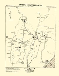
Back in 1988 I made a return trip to Onteora while in New York for my college reunion. I had been back several times on prior reunion trips and always enjoyed getting back to the "Land in the Sky." While there I found a copy of a camp map stuck on a bulletin board. Although it was ripped and mildewed, I was able to scan and clear it up through the magic of Photoshop. Click on it for a full-size copy.
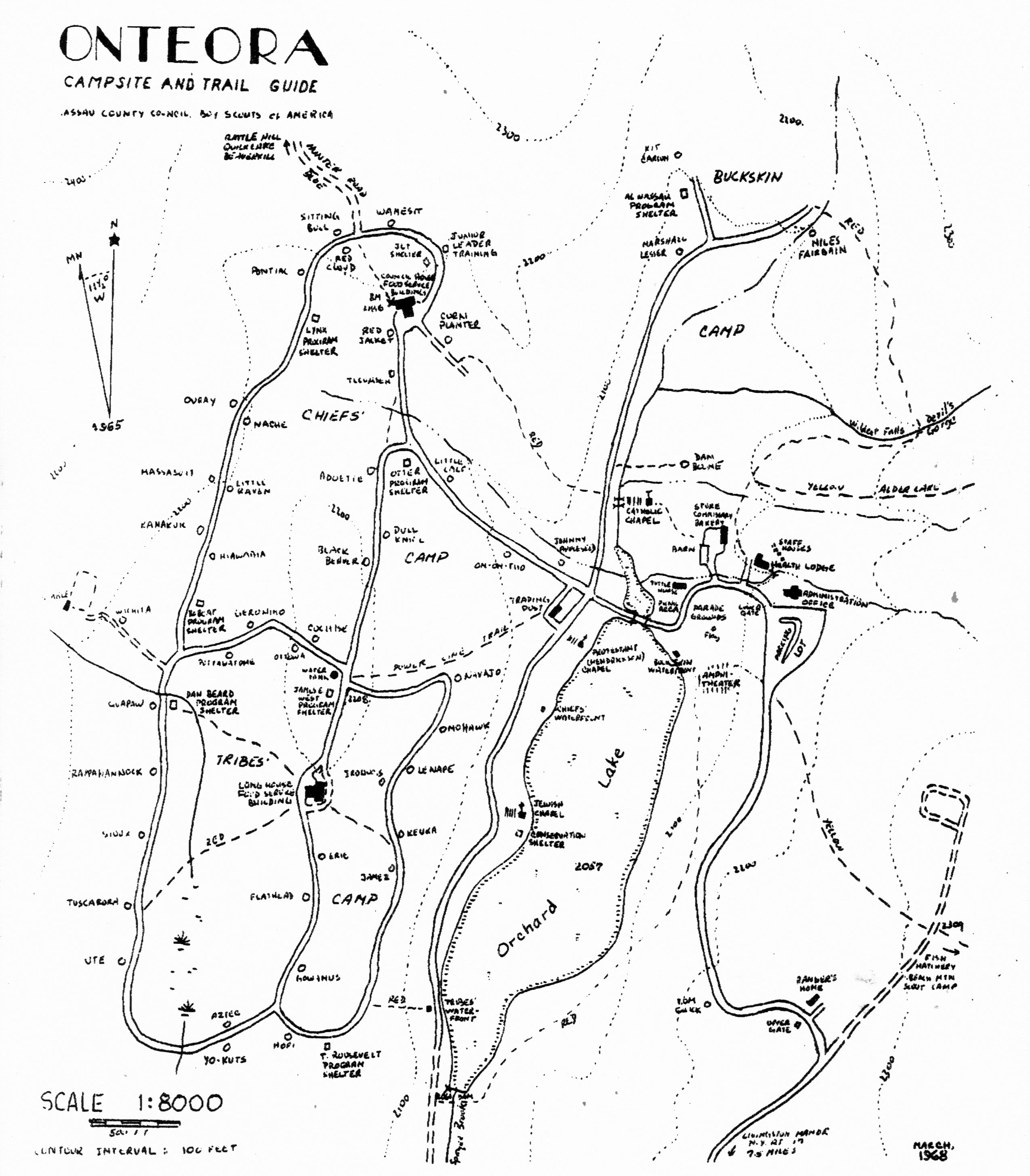
Here's a few things about the map that I found interesting. First of all, it shows Onteora as it existed in 1986, not as it was in its prime. Much of the Chief's area of the camp was no longer in use, and thus many of the campsites in that area were no longer listed. Other areas that I remember well, such as the stables, are replaced by things like "Field Sports Center". Now, though, thanks to the Internet, and Jean-Pierre Moreau and Dick Horn, who had copies, here's a map of OSR in 1968, at the peak of its operation. Take a look for campsites such as Aztec, Yo-Kuts, Johnny Appleseed and Dan Boone - most of them were in lousy locations and they didn't last long.
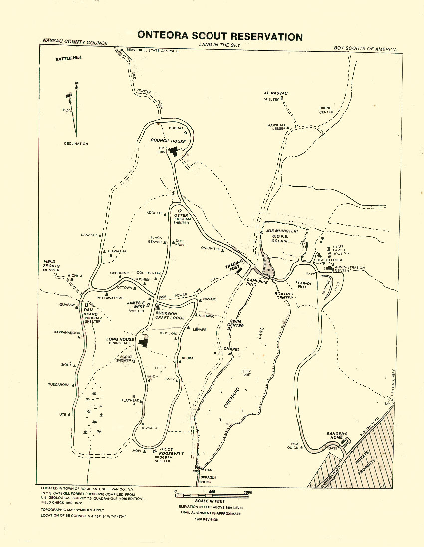
Let's take a tour of Onteora! Print out a copy of the camp map and follow along. I'll do my best to point out differences from Onteora as I knew it best, in the late 1960's, to what is shown on the map, and how it looks today. Please make allowances for the photos; some of them are scans of 30-year-old slides taken on a cheap camera. If anyone has photos for the site please let me know! Major highlights of the tour are shown in bold.
Here is a map of the general area to help you orientate yourself:
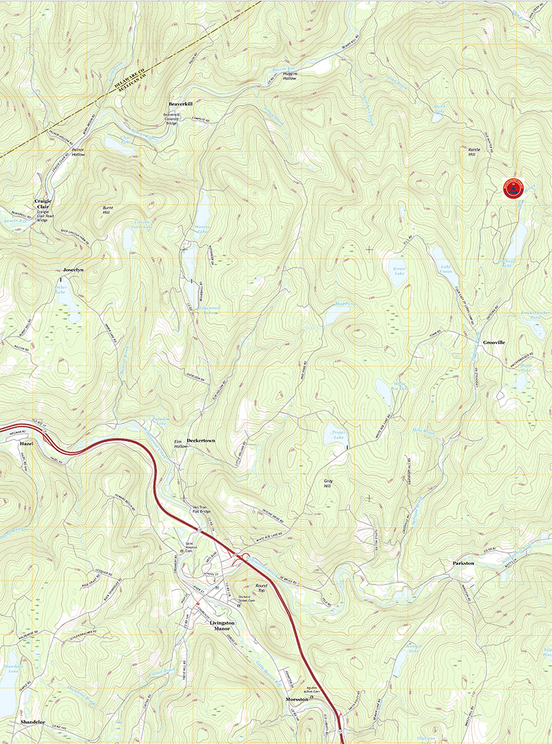
2016 topographical map
Click on the map for a full-sized copy in PDF format

Towards Grooville Road and Onteora (1998)
We'll start with the drive up to the camp itself. After heading north from Long Island on thew New York State Thruway and then Route 17, you'll eventually come to the exit for Livingston Manor. Take a right turn towards Debruce and keep an eye out for Grooville Road. When you spot the sign for "Onteora Scout Reservation." The sign is quite weathered and may be hard to spot; keep an eye out for the church on the left at the crossroads. Turn left and head up the hill. You'll pass over quite a few small bridges (all of which were nicknamed either for physical characteristics like the "piano bridge", which had loose planks that moved like piano keys as you drove over it, or for unfortunate counselors who had problems negotiating their way back after a night on the town.) Most of those bridges have been widened in recent years so the trip is not quite as perilous as in the past.

Artesian well (1998)
As you pass what was once the town of Grooville, look off to the right and you might spot the remnants of a former sawmill. Once powered by a Hupmobile (an antique car rarely seen these days), in 1968 there were still parts of a building, with pieces of unfinished church pews inside. Today, all that's left is some rusting machinery and some crumbling stonework. Also on the road, on the left side, is an ancient metal trough fed by an artesian well. While the former rusty pipe that fed it has been replaced by one made of PVC, the well is still flowing strongly. Next, after Grooville, you'll find yourself on Onteora Road. This takes you, not all that surprisingly, to Onteora.

Main entrance to Onteora Scout Reservation (1998)
You enter the camp through a stone gateway next to what was once the ranger's house. The building is now called the Gateway House and is home to the camps popular ATV program, and is also available for winter camping. There once was a stone structure on either side of the gate, with a hiking shelter off to the left. Click here for a look at it in the 1950s - boy, have the trees grown since then! Today, only the piece on the right has survived. On it, underneath the brown and yellow sign visible in the picture to the left, is a plaque that reads:
As we pass through this gate -
May we open our eyes, ears, hearts and mind
by Sterling W. Mudge
Council President, 1954-1957
Next, there's a long hill down to the main parking lot. On the way to the main part of the camp, you'll pass your first campsite, "Tom Quick." This lonely outpost, now abandoned, was used for canoe trips and other transient camper programs, and it seemed to be about as far away from everything as they could make it. Campers assigned to this campsite were hardly at Onteora at all; instead, they would stay for about two days as they prepared for their trips, cooking their meals in the campsite and pretty much staying to themselves. Then, after their canoe trip was over, they would return to camp, often to be seen enjoying a soda or ice cream at the Trading Post after all of those days on the river.

Administration Building (1988)
At the bottom of the hill is the main parking lot and the Administration Building. This is where troops check in, get their campsite assignments, pay their bills on the way out, and, in the pre-cell phone era, was where lonely Scouts lined up to use the only link to the outside world, a pay phone. The main room of the Center, with the large window seen in the picture, is ringed by flags denoting Onteora's success at national BSA ratings, for the camp was often one of the top-rated camps in the country. Offices to either side of the main room house the camp's administration and financial managers. The center also housed the camp's switchboard and later the dial telephone system. Downstairs, in possibly the world's dampest environment not located on an ocean, was once the home of the Staff Lounge, which mercifully has now been relocated. The Administration Building, by the way, replaced an earlier structure known as the Manor House, which was once the headquarters of the property's former owners, The Trout & Skeet Club of New York. The Manor House overlooked the Parade Ground, which in turn overlooks the lake. The Manor House was torn down when the Administration Center opened in 1965.

A-Frame houses (2009)
Tucked away in the woods just past the administration building are some other structures of interest, although most campers probably never notice that they are there. Four A-frame houses in the woods originally provided housing for the reservation director, his staff and their families. The houses are a striking design and were a much welcomed addition to the camp in the mid-60s. The A-frames are still there and are now in use for senior staff housing.

Blauvelt Health Center (1960s)
More visible on the road down towards the lake area is the Blauvelt Health Center, where a nurse and two assistants provided medical screenings and care during main days of the camps operation. Reflecting the reduced number of Scouts now attending camp, a smaller staff now operates the facility. All campers are required to take a brief physical upon arrival, and the staff has always been kept busy with a steady stream of sprains, burns, and other injuries you might expect in the woods. Although the actual name of the facility is the Blauvelt Health Center, I have never heard it called anything but the Health Lodge.

Camp barn (1998)
Continuing along the camp road, you'll come across what was once the camp bakery and commissary, now used as maintenance shops. The bakery was an amazing operation, turning out all of the baked products for the camp except bread for sandwiches. They did a great job on unexpected things like cream puffs and birthday cakes! One of my favorite past-times was arriving at the bakery just as they were heading out for a delivery run to the dining halls. The crew was always very generous in giving me a ride back up the hill to the Long House, and they also could usually be counted on to provide a few samples of the deserts they had just finished baking.
Located nearby was a very old barn, used in the winters to store the dock sections for the waterfronts and to house the camp's maintenance shops. I don't know how old the barn was, but it was built to last, with some of the most massive timbers and floor boards I have ever seen. Unfortunately, as time went by the roof became almost an equal number of holes as shingles. After years of neglect, the barn was pulled down in late 2000. Click here for an ill-fated plan to save the structure.

Wildcat Falls (1960s)
One of the most popular hiking trails in the camp can be found in this area. It is the Red Trail, which leads to Wildcat Falls, heading out from roughly behind the A-frames to the falls. For most of the years that I was at Onteora, Wildcat Falls hardly deserved the name. Instead of a waterfall, it was more like a trickle, with only a thin stream of water running down a moss-covered rock wall. In fact, it was usually possible to climb right up the face of the falls. That changed in 1969, when we had an amazing amount of rain during the camping season. The once placid stream became a raging torrent, totally impassable and running over its banks. It was an impressive display of the danger of underestimating Mother Nature!
Tour pages

