
From the Philmont Trail Guide:
Side Hike up Baldy Mountain from Copper Park - This is the best, safest and quickest access to the top of Baldy. West of the Copper Park meadow, you will reach a cabin just before a big turn in the road. At this bend, continue straight ahead on the foot trail. After fifty yards, you will encounter two switch-backs. Please stay on the trail. The trail continues up the canyon one-half mile before ending. From this point continue up the main canyon which will bring you northwest of the top of Baldy Mountain on a saddle. From the saddle, follow the ridge to the top. Do not try to hike up the face of Baldy above the Deep Tunnel Mine.
Back in the old days, the Baldy Town folk used to take Sunday trips to the top of Baldy from which can be seen northwestern New Mexico and southern Colorado. Baldy Mountain was the fertile womb of an active mining district. To the west, you look down at the Moreno Valley, where Elizabethtown once housed three thousand people, most of whom were engaged in mining. The far range in that direction includes Mount Wheeler, the highest mountain in New Mexico. To the southwest is Eagle Lake with a small town nestled at its head. Just below the top of Baldy on its western side, you can see the entrance of the Mystic Mine. A copper mine, it was the first shaft sunk in the Baldy area. The finding of copper led to the discovery of gold. Several soldiers stationed at Cimarron obtained from Indians copper that had been found near Baldy. The went to (the) Moreno Valley side of Baldy to sink a copper mine and found gold.
Copper Park derives its name from the large amount of blue-green copper float which is visible in this very high mountain meadow. The pipe you see rising from the middle of the meadow was where a core was removed in order to determine the geological formation below. Underneath Copper Meadow runs a tunnel of the Aztec Mine. You may camp either in the meadow itself or in the cleared forest to the west of the road. Your water comes from a pipe leading to the Deep Tunnel Mine. Between 1899-1927 the McIntyre Bros. drilled this mine completely through Baldy Mountain in hopes of discovering the "mother lode". They found nothing of value.
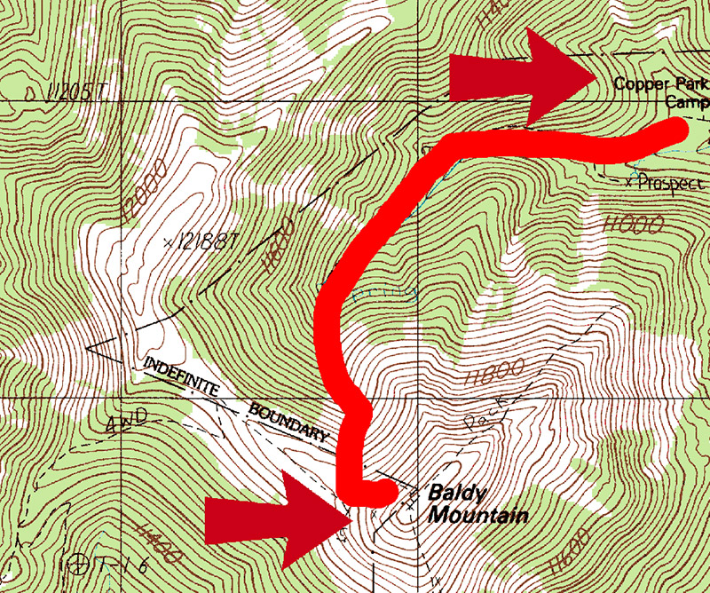
Route for the day
From my journal of 1967:
Woke up & frost was on ground - below freezing. Dew had dropped thru tents & all was wet. Left to climb Baldy right after breakfast (12,441 feet). Hike was long & steep - no packs. Almost was blown off near top. The top was very cold & windy. Saw some boys from Mr. Tobin's group on top. Got a lot of pictures - great view. Came down for lunch - very steep descent. Decided to stay at Copper Park all day instead of going to Pueblano Ruins. At night got some great pictures of antelope - was charged by two - got some great pictures of a head-on antelope charge.
What a day this was - the climb of Baldy. It was a very long, tough, and rewarding climb. As can be seen from the contour lines on the map, it was a steep hike to the top. The pictures that follow will show it wasn't a Sunday stroll in the park.
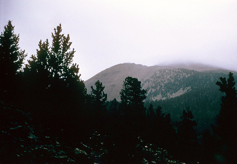
Baldy at first light
When we first woke up and looked up towards the top of Baldy, the clouds were so low we couldn't even see the summit.
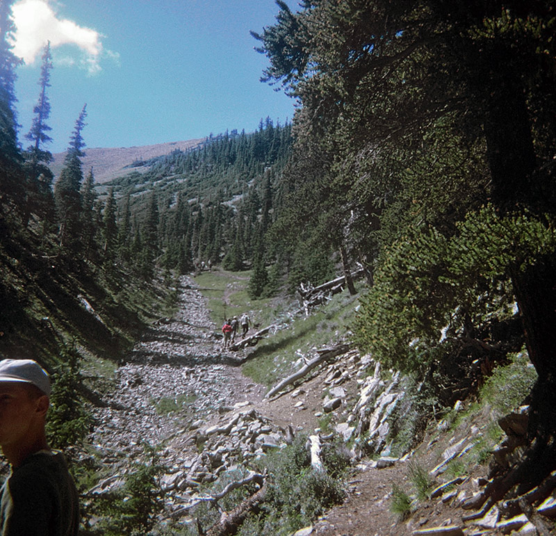
Beginning the hike up Baldy
At first, the climb was fairly easy. There were rocks in the center of the canyon, so we simply walked off to one side. One Philmont guide says these baseball-sized pieces were the result of weather and internal pressure on the mountain breaking up larger rocks, but at the time we all thought they were just pieces tossed down the slope by the miners over the years. That's Charlie Berenson, or some of him, on the left, inventing the photo bomb.
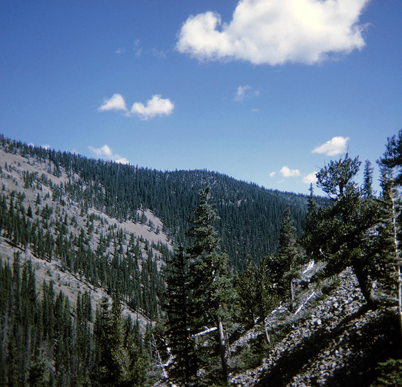
Nearing the tree line
As we climbed upwards, it got colder, and the trees became more sparse. Eventually, we passed the tree line, and there weren't any trees at all. In fact, there weren't even any bushes or flowers by the time we got to the top.
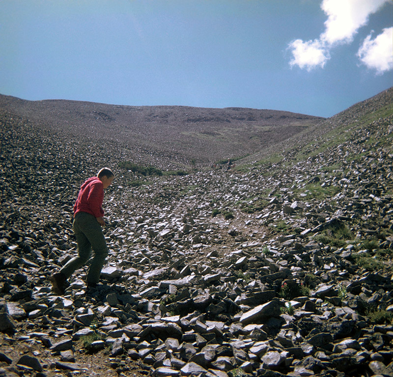
Tom Gavin and a billion rocks
After we passed the tree line, there wasn't anything up there but rocks. Rocks in every direction, covering every inch of the ground. This meant that there wasn't any clear trail, so we simply kept climbing up and up over the rocks.
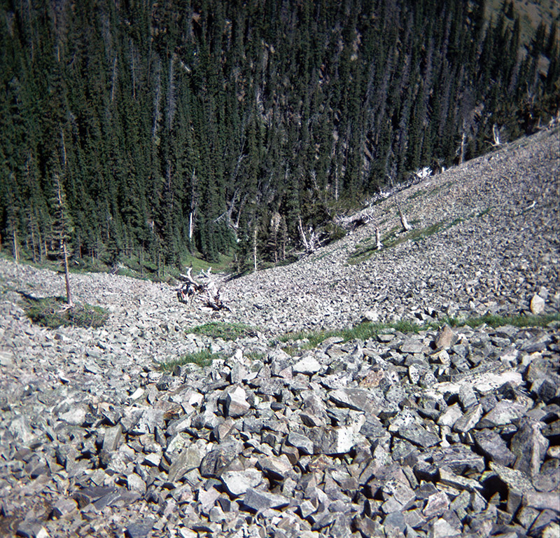
Looking back down the "trail"
We were all very careful to keep our balance and not fall backwards down the hill. This picture gives a good indication of the types and quantity of rocks we had to climb over.
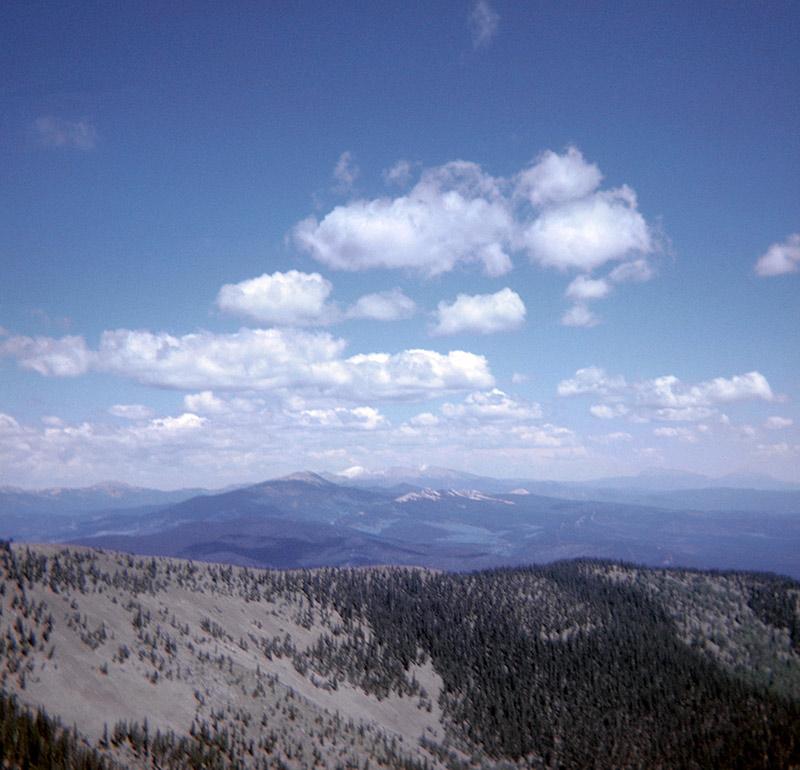
Snow-capped mountains in Colorado
Although it was cold and windy, it was still a beautiful day. You could literally see for miles and miles, as this view shows.
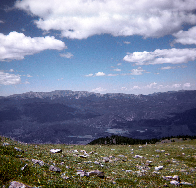
Another view of Colorado